The Cherokee Path
Inscription.[Front Side]:
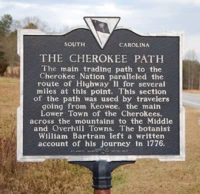
The main trading path to the Cherokee Nation paralleled the route of Highway 11 for several miles at this point. This section of the path was used by travelers going from Keowee, the main Lower Town of the Cherokees, across the mountains to the Middle and Overhill Towns. The botanist William Bartram left a written account of his journey in 1776.
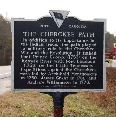
In addition to its importance in the indian trade, the path played a military role in the Cherokee War and the Revolution. It linked Fort Prince George (1753) on the Keowee River with Fort Loundon (1756) on the Little Tennessee. Expeditions against the Cherokees were led by Archibald Montgomery in 1760, James Grant in 1761, and Andrew Williamson in 1776.
Erected 1973 by S.C. Society, Daughters of the American Colonists. (Marker Number 37-3.)
Location. 34? 53.833? N, 82? 59.817? W. Marker is in Salem, South Carolina, in Oconee County. Marker is on Cherokee Foothills Scenic Highway (SC Highway 11). Click for map. Marker is located north east of the intersection of Highway 11 and Little River Road. Marker is in this post office area: Salem SC 29676, United States of America.Click here for more information from The Historical Marker Database